Generate continuous location data for fleets, couriers and devices: each ping a short, believable step from the last, with speed, heading and odometer that agree.
Free trial for every new account. No credit card.
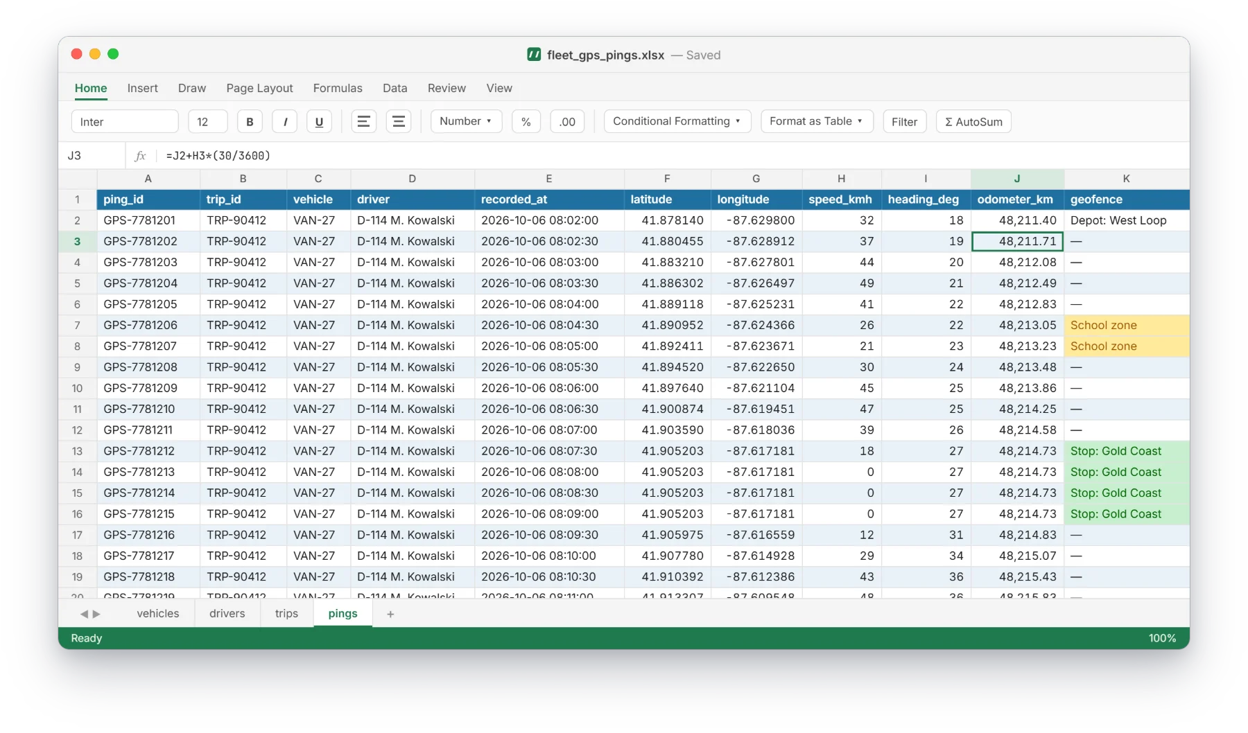
What to look for in the screenshot above. These are the details that usually break in hand-made or random test data.
Each position is a bounded step from the previous one, per vehicle or device.
Speed, heading, distance and odometer agree with each other.
Pings belong to trips, trips to vehicles and drivers, all joinable.
Export to CSV or JSON and load straight into a map, notebook or GIS tool.
Describe your data in plain English, or upload your SQL schema for PostgreSQL, MySQL / MariaDB, SQL Server and SQLite.
Check the tables, columns and rules the AI proposes, and adjust anything you like.
Choose how many rows you need and download a ready-to-run SQL script, CSV, Excel (one sheet per table) or JSON.
Yes. Give a start area and the paths stay within a realistic radius of it.
Yes. Each vehicle gets its own independent path.
Yes. The same approach works for asset trackers, phones and sensors.
Describe your tables or upload your schema. The free trial needs no credit card.
Start free